Digitalisation and innovation

'We have gone through a gigantic development here'
Ballast Nedam has never before carried out digitalisation on such a large scale as with the A24 Blankenburgverbinding. And with success: the BIM4Project-approach has been rewarded with a GEOBIM2020 award. But what exactly did we do?
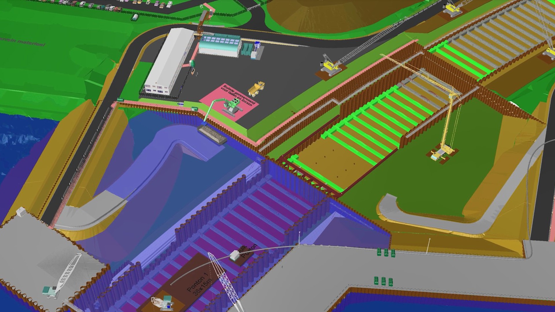
The immersed Maasdelta tunnel is one of the most complex parts of the project. That is why a special team has been put together to work on 4D planning within BIM techniques. In this method, the 3D models are linked to the 2D drawings and the planning of the project. This provides a visual experience model in which every step is made transparent. Because these models are shared with the engineers in the meantime, it leads to smarter and faster decision-making, a reduction in failure costs and smoother cooperation with the client and partners.
Thanks to the integration of point cloud data in the BIM model, the team can work even more accurately. This uses drones and laser scanning that take photos of objects in the construction environment. These photos actually consist of laser dots with a color code, so that the specialists do not have to model the built or existing object.
Infra Projects focused on, among other things, full 3D modeling of the temporary situation and the end situation, Virtual Reality, 4D planning and on-site capturing by drones and laser scanners. In doing so, the team gave a prominent role to digitization within the A24 Blankenburgverbinding. Thanks to these techniques, both the team and the client Rijkswaterstaat know exactly what to expect. “We have gone through a gigantic development here,” says Paulus Eckhardt, Director Digital Transformation and Innovation. “In this project we made smart use of the learning points from our work for the A9 Gaasperdammerweg. This allowed us to further improve our systems and create a detailed experience model in virtual reality. We can be proud of that.”
In this project, we made smart use of the learning points from our work for the A9 Gaasperdammerweg.
In BIM2Construct the entire project is built virtually, including all temporary situations. This 3D model ensures that the planning and costs are prepared in detail and that risks are made transparent in advance. Then, in BIM2Field, we guarantee the quality and progress of the project with drones, laser scanning and sensoring. Once the project has been completed, we can transfer all available data to the asset managers and operators during BIM2Operate. This allows the managing party to continue with the management and maintenance of the project. After completion, we maintain the Blankenburg connection for a period of 20 years.

Ballast Nedam is building the Blankenburg connection on behalf of Rijkswaterstaat. The route has a length of no less than four kilometers and is a succession of technical structures, including a land tunnel, two viaducts, a flood defense and a water tunnel. From 2024 it will connect the A20 at Vlaardingen with the A15 at the Rozenburg junction in the Rotterdam port area.
The water tunnel, the Maasdeltatunnel, is one of the most complex parts of the project. That is why a special team has been put together to work on 4D planning within BIM techniques. In this method, the 3D models are linked to the 2D drawings and the planning of the project. This provides a visual experience model in which every step is made transparent. Because these models are shared with the engineers in the meantime, it leads to smarter and faster decision-making, a reduction in failure costs and smoother cooperation with the client and partners.
Thanks to the integration of point cloud data in the BIM model, the team can work even more accurately. This uses drones and laser scanning that take photos of objects in the construction environment. These photos actually consist of laser dots with a color code, so that the specialists do not have to model the built or existing object.
What concretely does BIM4Project deliver for the Blankenburg connection? Team leader Digital Construction Tommie Jacobs explains: “With 4D planning we can visualize whether what we originally thought of is correct. It ensures that interfaces and adaptability problems are identified in good time. It reduces risks and it gives the team the opportunity to include other collaboration partners in the process at all stages.
We immediately see our choices reflected on the construction site
Miscommunication can lead to unsafe situations. We use a 4D model to identify unsafe situations before they actually take place on the construction site. We can include our safety experts early in the process, so that unsafe situations are prevented in time. “At the Blankenburg connection, we saw during the modeling that an unsafe situation was imminent on a part of the construction site where cranes and trucks drive back and forth,” says Tommie. “Because we already identified it during this stage, we were able to decide to create an extra walkway and shield the area from construction traffic. The great thing about this story is that you can now see it back on the construction site.”
And that's not the only part that actually turned out exactly as in the models. At the Rozenburg junction, the team is taking considerable steps to collect data by drones and laser scanners. There are almost no deviations, which means that almost everything is executed as planned in advance.
“In short, streamlined processes, we continuously take steps forward in the further development of digitization in projects,” says Paulus. “We are not only concerned with the end result, but also with the journey towards it. And we also enjoy the trip.”